|
Most parts of the country will continue to experience isolated rain showers caused by the easterlies, the weather bureau said Tuesday.
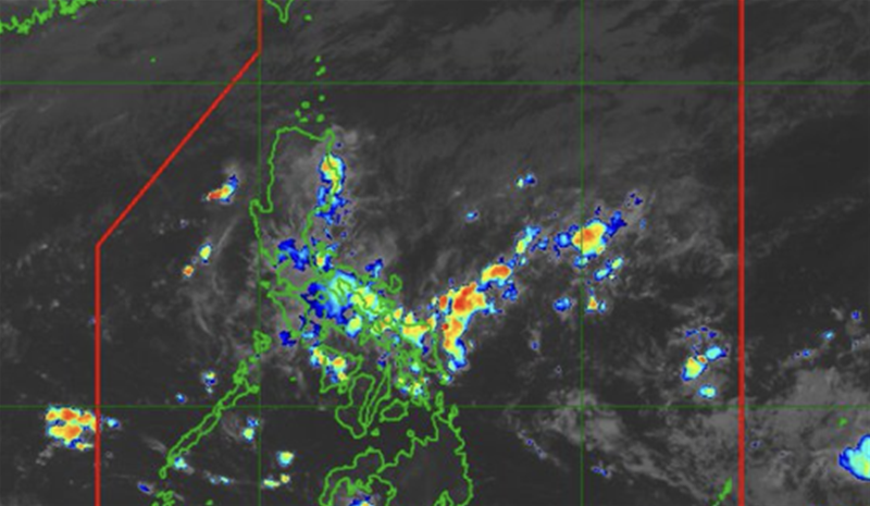
The frontal system affecting extreme Northern Luzon, however, will bring scattered rains and thunderstorms over Batanes, Cagayan, Ilocos Norte, Ilocos Sur, Apayao, Abra, and Kalinga.
Moderate to heavy rains in those areas could result in flash floods or landslides, the Philippine Atmospheric, Geophysical and Astronomical Services Administration (PAGASA) said.
Metro Manila and the rest of the country will continue to experience isolated rain showers or thunderstorms.
Moderate winds and moderate seas will prevail over extreme Northern Luzon.
Elsewhere, winds will be light to moderate with slight to moderate seas.
As of 2 a.m., no low pressure area was monitored for possible tropical cyclone formation.
Meanwhile, the heat index or the temperature felt by the human body when relative humidity is factored in with actual air temperature, could peak at 46°C in Sangley Point, Cavite City.
A 45°C heat index is forecast in Daet, Camarines Norte; Legazpi City, Albay; and Pili, Camarines Sur.
The heat index could reach 44°C in NAIA; Dagupan City, Pangasinan and Masbate City, Masbate.
The heat index could peak at 43°C in these areas:
Iba, Zambales
Muñoz, Nueva Ecija
Infanta, Quezon
Calapan, Oriental Mindoro
Coron, Palawan
San Jose, Occidental Mindoro
Roxas City, Capiz
Mambusao, Capiz
Iloilo City, Iloilo
Dumangas, Iloilo
Guinobatan, Albay
A 42°C heat index is forecast at Science Garden in Quezon City.
Under "danger” level conditions, ranging from 42°C to 51°C, the public is warned of increased risks of heat cramps, heat exhaustion, and heat stroke with prolonged exposure.

|